Information and photos of my mountaineering trips in Scotland,England and Wales:
Including hillwalking,scrambling and easy rock climbing.Also via ferrata, skiing and alpine trips in Europe.

Like this blog!

Monday, 13 August 2012

Wild camp - Lochnagar 11th August 2012.


After a leasurely drive through Glenshee and Braemar, where we stopped for a cup of tea, we passed through Ballater and parked at a very busy Lock Muick visitors centre. (Muick pronounced "Mick").  

Our first views of the cliffs of Lochnagar and a chance to scout around for a decent spot to camp for the night. The wind was picking up and it took us ages to find somewhere even slightly sheleterd and not too wet. The cloud was also slowly building and our dream of a picturesque sunset were soon dashed. Finally we found a half decent spot a couple of hundred metres south of the summit of Meikle Pap.  

This would be the first outing of our new Vango Omega 250, which was a bargain at £75 from Decathlon of all places. It has the vango TBS tension system inside, which turned out to be useful as the wind picked up! It also has a detachable, bathtub style groundsheet for the porch area, however we didn't use it on this occaision.       

Despite the glorious views over the royal estate, it was getting a bit wild so after tea we checked the tent over once again before getting cosy inside.

As darkness fell I was hoping to light one or both of the fire logs we had lugged up there for a cozy camp fire. However the strong winds made it difficult, but I was determined not to carry them back. Eventually I found a (slightly) sheltered spot and had something resembling a camp fire going, although Lorna wasn't too impressed as I insisted she brave to cold and wind to sit next to it! 

After a windy , but secure night in the Omega 250, we had breakfast , packed up and headed up to the plateau and followed the rim of the crags round to the first summit of Cac Carn Mor at 1150m.

As we made our way round the mist came and went giving the occasional view down some of the gullies, in this case, back over to Meikle Pap.  

Again, some tantalising glimpses down some big gullies.

This being my first visit here, I wasn't sure of the names of the gullies that are popular in the winter, but hopefully I'll get to return to see them from within! Finally we made it top a very windy and foggy Cac Carn Beag at 1155m; the second summit, from where we turned and headed south east, following the Glas Allt down to Loch Muick. Sadly there was a fair bit of litter around, even the coals of a barbeque someone had had amongst the summit rocks! 

The long path down the Glas Allt get more interesting and scenic as Loch Muick comes into view.

Eventually we came to the Glas Allt Falls, which you can get to by a short detour left off the main path. I don't know if they freeze enough in winter to be climbed, but they do look good. 

Nearly down to the loch with a short section through the trees to Glas Allt Shiel. Another possible wild camping spot?

Once past the north west shore of the loch, we turned east to make for the car park, when I noticed this chap casually crossing the path.


Looking back down Loch Muick as we head for Spittal of Glen Muick, and a short drive to Ballater for a night in the campsite there.


Sunday, 15 July 2012

Wild camp - Dalehead Tarn, 14th July 2012.

Myself, Lorna, Ruth and Ian drove down to Skelgill, to the west of Derwentwater near Keswick, to do the shortish walk in over Catbells to Dalehead Tarn. This would be Lorna's first real wild camp carrying gear, so it had to be a relatively easy one!
After crossing over Maiden Moor (great views over to the Scafell range), we dropped down over High Spy and Eel Crags to Dalehead Tarn, our camp spot for the night. Unfortuneately the sheepfolds were full with tents, although the main one was wasted by a group of guys having a fire in the middle, instead of using it as shelter! So after a bit of hunting around we managed to find a spot relatively sheltered from the incoming rain. We even managed to light a fire briefly before the rocks we built it on exploded with the heat!

After a reasonable night, we had breakfast, struck camp and climbed up over Dalehead at 753m, and followed Littledale Edge, North West, passing Hindscarth to the right on our way. After crossng over Robinson, we dropped down to Newlands Hause and had a bite to eat at the foot of Moss Force. I would be possible to drop down to Buttermere and camp there for the night as a three day walk. 


Looking across towards High Stile and Red Pike above Buttermere.

Lunch at the foot of Moss Force at Newlands Hause, before turning North East and heading over Knott Rigg and Ard Crags.

Lorna on the short but steep climb up Knott Rigg with the Buttermere valley behind.

Ian and Ruth on Knott Rigg, with Causey Pike (i think?) behind.

Looking South East from near Knott Rigg, back over to High Spy on the left and Dalehead on the right. Dalehead Tarn, out of view, sits right in the middle of the two.

Descending Red Screes after Ard Crags, and looking into the Newlands Valley as we head back to Skelgill and the car.   

Sunday, 1 July 2012

Cateran Yomp, 30th June 2012


Myself , Lorna, Shona and Jerry completed the 24 mile (ish - no-ones quite sure of the exact distance) Bronze section of The Cateran Yomp today. The money raised, £1600 in our case, goes to the ABF (Army Benevolent Fund) to help amongst other things injured soldiers returning from Afghanistan etc.

The route starts at Blairgowrie, and takes a clockwise route north up to The Spittal of Glenshee before heading back to Blairgowrie for the whole 52 mile (Gold) distance. After the problems Lorna has experienced with her ankle, she was pleased to to have done the 24 miles without too much trouble. The route was very muddy in places and we did well not to get wet feet and suffer from blisters!

Tuesday, 26 June 2012

The Bell - Swirl How - Coniston Old Man, 26th June 2012

A better forecast gave us the chance to try the short (50m)but entertaining scramble on "The Bell",  just to the east of Coniston Old Man. We did this a long time ago, but now Lorna was feeling up to trying it to see how her ankle would cope. As a grade 1 scramble , there are loads of escape routes but you can make it more difficult with some air below your feet.  
Lorna enjoying her first taste of scrambling for over a year on The Bell.

As you make your way roughly north west over Below Book Felsls, you cross a series of small craglets which give good safe opportunities to practice moves with lots of grassy escape routes. We dropped down to Low Water, and then made uor way up to Levers Water via the old mine workings.   

Levers Water from the mine workings. Wild camp?
One of the very dodgy looking holes left by the mines that are around the edge of Levers Water.
We made our way along the east side of Levers Water, passing the grade 3 scramble on Raven Tor (seen above) on our left.
After Levers Water, comes another ascent to the coll between the Prison and Wetherlam. From here it's a nice scrambly path up to Swirl How at 802m, before heading south towards Coniston Old Man at 803m. After a quick snack (in the mist once again!), we went north west a short way to reach the top of the path descending to Goats Water. 
Yet again no views of the cliffs of Dow Crag as we continued down past Goats Water and back onto the Walna Scar road leading back to the car, just south of The Bell. 

Sunday, 24 June 2012

Dow Crag from Torver, 24th June 2012

We managed to get a last minute booking for a cottage at Water Yeat, through Coppermines Cottages based in Coniston, hoping we had made the right choice with this summer's dodgy weather. Our previous week when we were up at Pitlochry was wet for the most part. I had wanted to walk up to Dow Crag for a look prior to hopefully returning later in the year to repeat the climb/scramble (?)  up "Easy Terrace". We parked at Torver and followed the path which loosely followed Crook Gill up past the old mine workings with the flooded gravel pits, and onto the Walna Scar road, before branching off onto the path for Goat Water. At this point the weather turned (as usual this summer) leaving very few photo opportunities due to amount of water lading on us! We made our way round from the coll at the top if the well made path from Goats Water, west and then up and over (south) the summit of Dow Crag.      
Occaisionally we would get a brief gloomy glimpse down one of the big gullies (but which one???), and then it was down to rejoin the Walna Scar road, and then retrace our steps back past the mine workings down to Torver.
As is always the case, we finally saw some of Dow Crag as we we dropped down into Torver. Time for a pint!

Sunday, 17 June 2012

Stob Ban, 16th - 17th June 2012

Hoping to miss the "eye of the storm" of bad weather over most over northern Britain, myself Bruce, Gordon, Mark and Willy drove up to Spean Bridge to climb Stob Ban in the Grey Corries, and hopfeully find the Lairig Leacach bothy empty and so not have to use the tents! It did rain for most of the short walk in and after stopping to talk to a group walking back to their cars, we were lifted by the thought that (according to said group) , the bothy was indeed empty. 
The Lairig Leacach bothy comes into view and it's a race for the best bunk space!
As usual we had all carried one fire log each, plus a now unrequired tent, so we had no problem getting the fire going for most of the evening. There is bunk space for about 6 to 8 people depending how cosy you want to get and you could fit a couple on the floor, although that may be tight with all the kit. There are about 5 chairs and a long kitchen worktop where we put all the cooking and foodstuffs. Only one window and a skylight though, but with the long nights at the moment it never really got dark.      
After a few beers and a comfortable nights sleep we were treated to slightly better weather although it was still quite chilly. Our first hill of the day would be Stob Ban at 977m high, seen here behind the bothy. 
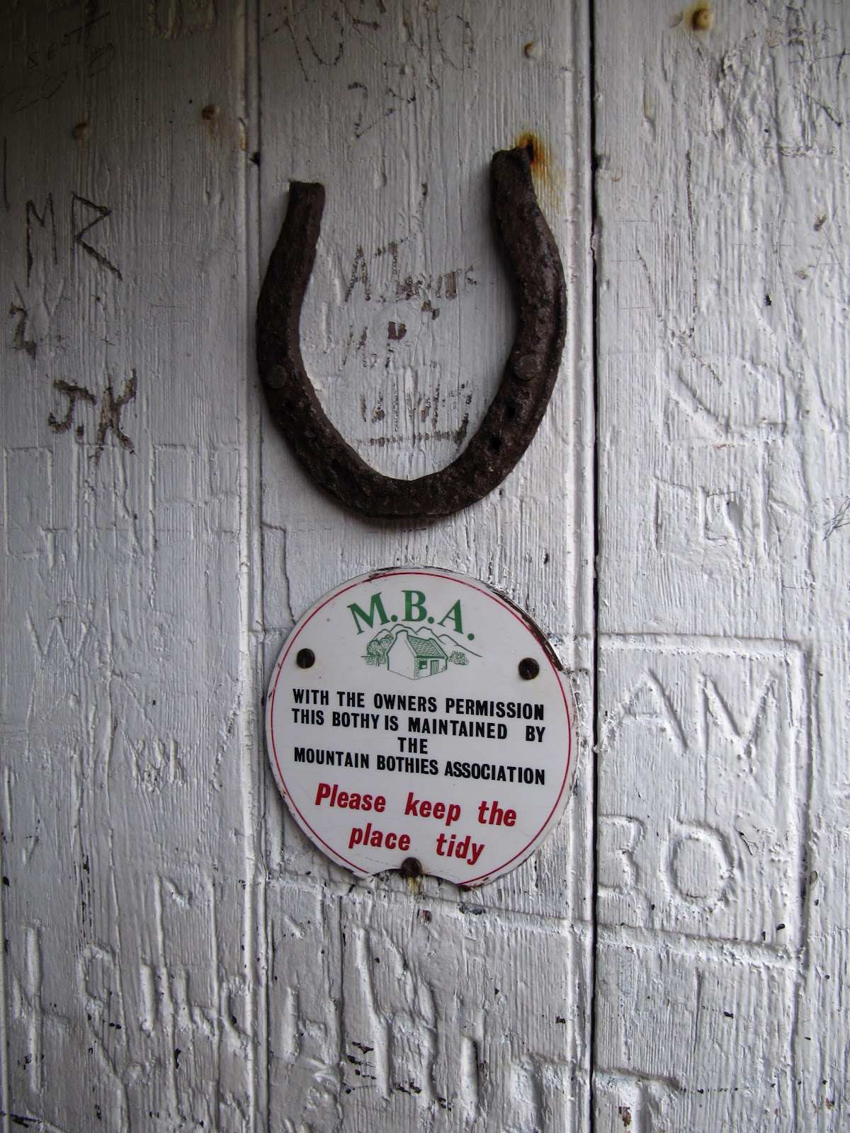
If you do use any of the mountain bothies, please take all your un-burnable rubbish with you and leave the place as clean and tidy as you can.
Looking back down to the Lairig Leacach bothy as we made our way up to Stob Ban.
From the top of Stob Ban, we descended north before climbing up to 1177m to the summit of Stob Choire Claurigh. On the way we were surprised to find quite large south facing snow pathces which were still quite hard. Not quite neve, but a slip would send you down a few metres!  
From Stob Choire Claurigh we headed north again along the short easy ridge to Stob Coire na Ceanain at 1123m. It was from here that the hill fog came in and any further views and photo opportunities were gone. Again we headed north along the rim of and then descending back to the cars.
On the way back we passed , once again the "" casting his eerie gaze over Lochaber.

Monday, 4 June 2012

Wild camp at Angle Tarn, 3rd June 2012.

My second (true) wild camping trip of the year was to be at Angle Tarn, north of Bowfell. Myself, Gordon, Mark, Willy and "newcomer", John, first popped into the Old Dungeon Ghyll Hotel to get hydrated before we set off for The Band via Stool End Farm. The weather so far was staying ok, and there were a few climbers out on Middle Fell Buttress (and others?) as we watched from the comfort of the beer garden!     
After the slog up The Band, we came to the branch in the track that heads off right for the Climbers Traverse. There isn't much flat ground till you reach about the 700m point after about a mile, where the path then weaves it's way along under Flat Crags, Cambridge Crags and on to Bowfell Buttress.   
As Bowfell Buttress comes into sight the path rises then falls, and becomes messier, until you reach (on your left), "a river of stones", as Wainwright called the path heading up past The Great Slab.
Just past the "river of stones", below Cambridge Crags is a spring that drips safe drinking water.
Another short slog brings you up alongside The Great Slab, which if you can be bothered to cross the boulders, is actually easier to walk on before turning slightly right to head past Bowfell summit, then North down to Ore Gap. At the gap we turned right, off the main track to Esk Pike and dropped down to Angle Tarn. At first sight of the tarn we saw quite a few tents already pitched which was worrying.     
However once we got down there we managed to find a half decent spot with enough room for five tents!
After some dinner, cheesy pasta (with some of Gordon's left over couscous) and chocolate flap-jacks, it was time to set the fire and have a few beers!  
I was pleased with my new Lifeventure Downlight 1200 sleeping bag that I picked up on sale at Go Outdoors too. I slept in just shorts and was fine whilst some of the guys seemed to find the night a bit chilly, or slept with some gear on. Plus my new 3/4 Multimat seemed ok too. Sunday morning was bright but still a bit windy but at least it was dry as we headed back up to Ore Gap leaving the dozen or more other tents behind us.      
John trying to enjoy his baptism of fire (carrying a wardrobe on your back!) with us on the summit of Bowfell at 903m with the Scafell's behind.
From Bowfell we headed south down the rough path towards the Three Tarns and Crinkle Crags.
Another nice view of the Scafell's from the Three Tarns area. We avoided the so called "bad step" on the way down. Having done it before I can vouch that it is really easy but with a heavy pack might put people off down climbing it. After descending over Great Knott we took a left just before Pike of Blisco to drop down into Oxendale.   
Looking back up the Crinkles as we head for the pub!
Willy and John about to cross the bridge over Oxendale Beck with Pike of Stickle, Gimmer Crags and Harrison Stickle in the distance.