No photos from this weekend - too wet, well Saturday was not too bad but that was just a walk from the NT campsite to the Wasdale Head Inn for a pint of Dickie Doodle. However the BBC/Met Office forecasts (on Friday afternoon) for, "white cloud and occasional light showers" on Sunday, turned out by Saturday's forecast to be almost constant wind and persistant rain.
Sam and myself had an optimistic notion of doing the Climbers Traverse around the bottom of the Napes ridges, then "thread the needle", and possibly Sphinx Ridge. On the walk up to Styhead from Wasdale, we did see two people high above the mist, probably on the upper part of Sphinx Ridge.
Any remote hope we had of doing that was stopped as the rain continued and got heavier. At this point Scafell Pike was still visible - almost. So we continued to the stretcher box at Styhead with the idea of maybe climbing England's highest peak - a first for Sam.
However as we reached Styhead, the cloud base lowered, the wind increased and we got wetter! Some people may see it as a challenge, but I don't see the point in trudging through wind and rain with no appreciable view to end up in the mist by a trig point that could be anywhere.
So we didn't!
To make a walk of it, we went up past Sprinkling Tarn and briefly thought about heading for Bowfell but it was so grim we about turned and headed back to the Wasdale Head Inn for food and more Dickie Doodle!
Sunday, 2 October 2011


Tuesday, 20 September 2011
Scotland’s Mountain Safety Day.
Scotland’s Mountain Safety Day
Saturday 8 October, 10am-4pm
Albert Halls, Stirling
More than 30 mountaineering and related organisations combine in a single event to promote Mountain Safety.
Having the right skills for Scotland’s mountains means you can be self-reliant and enjoy our superb landscapes and a fantastic world of adventure without travelling to the ends of the earth. Confidence in the mountains starts with knowing where to get the right equipment and the best advice.
So if you need advice about buying boots, want to know more about navigation or how the mountain rescue services operate, then come along to Scotland’s Mountain Safety Day in Stirling on 8 October to enjoy an informative and fun day and meet top suppliers and mountain-related organisations.Organised jointly by the Mountaineering Council of Scotland and hill walking charity Mountain Aid, the aim of the event is to inspire you to enjoy the Scottish Hills safely, and there will be displays, workshops and presentations that will help you to acquire or improve the skills and knowledge needed for a safe and pleasurable day out on the hills.
Entry to the event is absolutely free, although there will be a useful souvenir programme on sale for £2, which includes one entry to a prize draw with some fantastic prizes. The event will be officially opened by Mountain Aid’s Patron, Cameron McNeish, who will give an illustrated talk at 11am.
The organisations taking part include:
The Mountaineering Council of Scotland and Mountain Aid; The Scottish Mountaineering Trust; Mountain Rescue Committee of Scotland; Killin Mountain Rescue Team; Lomond Mountain Rescue Team; Ochils Mountain Rescue Team; Mountain Weather Information Service (MWIS); John Muir Trust; Mountain Bothies Association; The National Outdoor Training Centre - Glenmore Lodge; Mountain Leader Training Scotland; sportscotland Avalanche Information Service; ScotWays; the Search and Rescue Dog Association; Harvey Maps; C-N-Do Adventure Holidays; National Navigation Award Scheme; Ramblers Scotland; Ochils Mountaineering Club; Cotswold Outdoor; Nevisport; Tiso; Cicerone Press; Jonathan Binny; Scottish Community Foundation; Scottish Independent Hostels; SYHA Hostelling Scotland, Duke of Edinburgh’s Award Scheme; Scotland Outdoors; and the popular hill walking website walkhighlands.
There will be presentations on the causes of mountaineering incidents; navigation techniques; mountain weather forecasting and mountain first aid and, weather permitting, an outdoor climbing wall for children [and adults] to test their skills, supervised by professional staff.
The event is supported through generous donations from the Scottish Community Foundation and the Scottish Mountaineering Trust and starts at 10am at The Albert Halls, Dumbarton Road
Stirling FK8 2QL.
Sunday, 28 August 2011
Wild camp at Haweswater Reservoir, 27th August 2011
 |
| Myself, Mark, Willy and Stevie made the decision that wild camping in Scotland this weekend could be a wet affair, so we headed south to the hamlet of Low Harstop between Patterdale and Brothers Water. Limited parking is available here. |
 |
| A steadily rising track follows Hayeswater Gill to Hayeswater itself before heading north-east up to The Knott from where we headed south. |
 |
| The track from The Knott leads to High Street at 828m, but we branched off east over Kidsty Pike and down to the shores of Haweswater. |
 |
| As we passed over Kidsty Pike we got our first view of our canping spot for the night down towards the bottom of The Rigg, the long ridge running right to left in the picture. |
 |
| A closer view of a very quiet shoreline where we only saw two other tents over towards the tree line. |
 | |
| With the tents all up it was time to get some food and get the fire going. |
 |
| Don't worry, the firewood was brought by us! 99 pence for a self lighting long that lasts up to two hours! |
 |
| Early morning sun from the doorway of my tent. |
 |
| Peace and quiet. |
 |
| Cup of tea followed by porridge (mashed up flapjacks in milk) and bananas. |
 |
| Some of the remaining dry stone walls that were part of the village of Mardale before it was flooded to create Haweswater Reservoir. |
 |
| After a leisurely breakfast we packed our gear and set off up The Rigg towards High Street. As we gained height we got better views down Hawwswater. |
 |
| The Rigg itself rises up from the waters edge and gains roughly 600+ metres of height. |
 |
| Halfway along The Rigg looking back down to Haweswater. |
 |
| Small Water, just visible to the left of The Rigg, sitting below Harter Fell and Mardale III Bell. |
 |
| Blea Water is also passed en-route. Only one small tent was spotted on the shoreline. |
 |
| From High Street we walked South West to Thornthwaite Crag at 784m before descending into Threshwaite Cove via Threshwaite Mouth before following Pasture Beck through Threshwaite Glen back to Low Harstop. |
 |
| I had read there were possibly some grade 1 or 2 scrambles on Raven Crag in Threshwaite Cove, but was surprised to see what looked like people rock climbing on the crag as we passed. |
Sunday, 21 August 2011


Sunday, 14 August 2011
Stalden to Gspon, in a cable car of course! 14th August 2011
 |
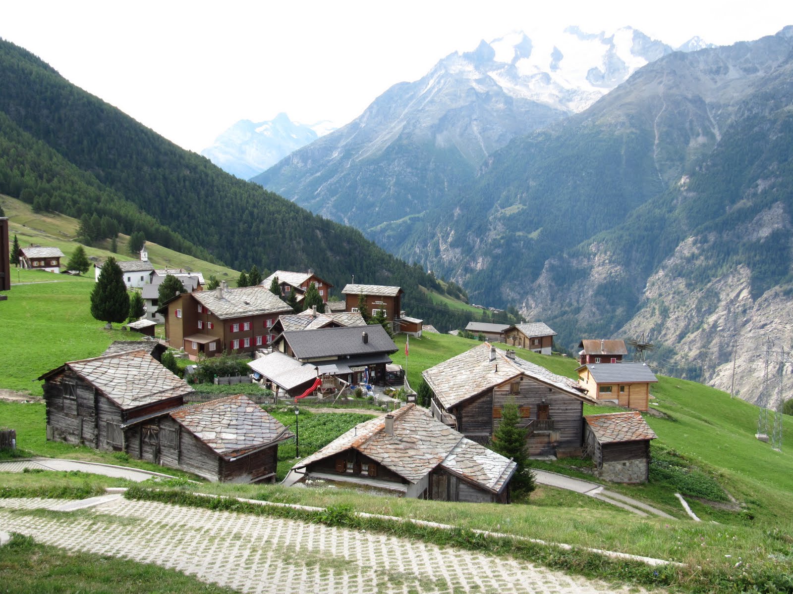
| Once I arrived at Stalden it seemed only right to take the cable car up to Gspon at 2000m. To this day there are no roads up to the village, so I don't know how they get all the bulding materials for some of the new chalets that were being built!. |




Subscribe to:
Posts (Atom)